Mapping of soil erosion by water
Soil erosion mapping project helps stewardship managers understand, respond to trends, patterns
By Laura Hopkins, GIS Technical Assistant, Maitland Valley Conservation Authority
Maps and the analysis of mapped data (typically called Geographic Information Systems, or GIS) allow conservation managers to discover trends and patterns about the landscapes they manage. GIS can help conservation managers to learn new information that might not be obvious from the ground. GIS can be used to determine which locations are more vulnerable to threats such as flooding or erosion.
The five conservation authorities of the southeast shore of the Lake Huron basin worked together to develop consistent mapping methods to learn more about the risk of soil erosion throughout the basin. Mapping soil erosion risk is important because soil erosion leads to water quality issues when soil particles leave the land and enter our streams, rivers and lakes. Soil erosion can be caused by either wind or water, and the focus of this project was soil erosion caused by water, typically called water erosion.
The Ontario Ministry of Agriculture, Food and Rural Affairs (OMAFRA) provided water erosion risk mapping based on rainfall, soil, and slope characteristics for the Lake Huron basin. Together, these three characteristics make up the inherent water erosion risk because these conditions are inherent to the landscape and cannot be easily influenced by land use practices.
OMAFRA’s erosion classes of severe; high; moderate; low; and very low were used to classify the inherent water erosion mapping. Figure 1 shows the inherent water erosion map of the Lake Huron basin. This information was used to calculate the land area each erosion class covers for each conservation authority. In this way, by using consistent data and methods, inherent water erosion risk across the Lake Huron basin can be compared and used to identify locations with severe inherent water erosion risk.

Figure 1. Inherent Water Erosion Risk of the Lake Huron Basin.
Locations with severe inherent erosion risk tend to have steeper slopes which can be difficult to farm. This means that some of the severely erodible land is kept under natural land covers, such as forests and grasslands, which are effective at reducing the risk of erosion. The land area with severe erosion risk that’s currently under natural land cover was calculated for each conservation authority.
Figure 2 shows the inherent water erosion risk as well as natural land cover for a small section of the Lake Huron basin. Maintaining the natural land cover of these severely erodible lands is an important stewardship priority in the basin because natural land covers help to protect the water quality in our rivers and lakes.
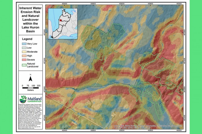
Figure 2. Inherent Water Erosion Risk and Natural Landcover within the Lake Huron Basin.
The percentage of each erosion class that’s under agricultural production was calculated for each conservation authority. In this way, it was possible to compare how much severely erodible land is currently under agricultural production across the Lake Huron basin. Additionally, crop rotations were analyzed to estimate how much of each erosion class is under a rotation with three or more crop types (such as corn; soybean; wheat; corn) compared to a rotation with two or fewer crop types (such as corn, soybean). This mapping allowed for comparison of crop rotations throughout the basin, which vary from north to south.
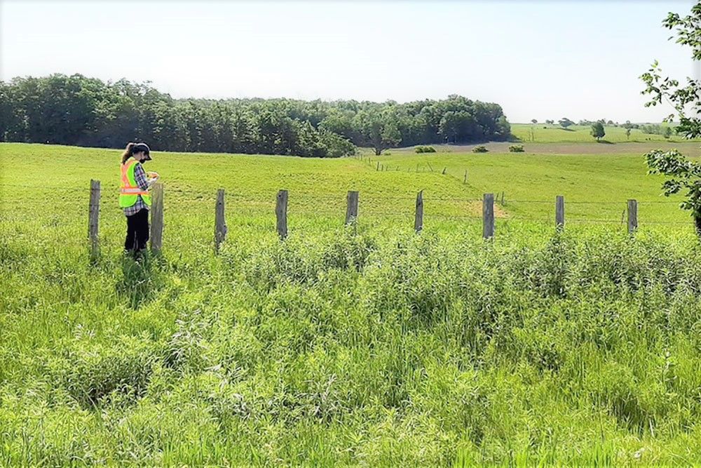
In addition to the inherent water erosion risk mapping, Maitland Conservation is testing more advanced GIS analysis in a smaller subwatershed to identify locations that are vulnerable to erosion and runoff. By testing these more advanced GIS analyses in a smaller subwatershed, the accuracy of the mapping can be checked by driving the subwatershed and comparing on the ground observations to mapped information.
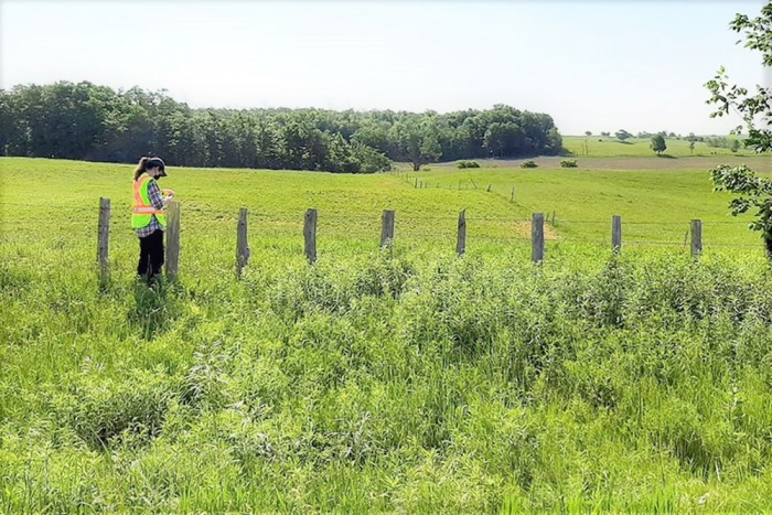
Figure 3. Maitland Conservation Employee Verifying Mapped Information.
Identifying areas with severe inherent water erosion will help the Healthy Lake Huron team understand risks to water quality across the basin. The amount of land in natural cover, as well as the land in a 3+ crop rotation, are both useful indicators that can be used to assess changes in land management over time across the basin. Overall, the analysis will help the Healthy Lake Huron team plan future stewardship activities and monitor changes in land management over time. The team is considering additional analysis to build on this effort.