Watershed Report Cards report on water quality
Watershed Report Cards reveal stressed conditions in some Ontario watersheds
What are the forest conditions and water quality in your local area? New Watershed Report Cards can help to answer those questions.
Conservation authorities prepare the report cards every five years. They released the report cards on World Water Day “to bring attention to how important it is to protect our lakes, rivers, streams, and groundwater,” said Kim Gavine, General Manager of Conservation Ontario. The Great Lakes, rivers, and groundwater are sources of drinking water and a resource for a number of other recreational and economic uses.
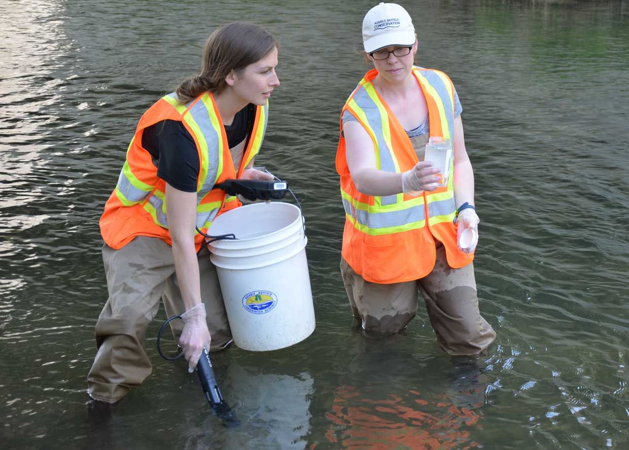
The Watershed Report Cards provide science-based information to landowners, residents, and community groups as well as for government and agency partners. Most conservation authorities monitor and report on three resource categories: surface water quality, forest conditions, and groundwater quality. Some conservation authorities have also provided information on the state of wetlands in their watersheds. They obtain data through tools including local monitoring programs and provincial monitoring networks.
The report cards show that many of Ontario’s watersheds – particularly those in southern areas – are stressed, according to Conservation Ontario. Across Ontario, Watershed Report Cards show an average grade of ‘C’ for surface water quality and ‘C’ for forest conditions but in some local watersheds grades are even lower.
Groundwater is much more difficult to assess on a watershed-wide basis. Groundwater aquifers do not conform to watershed boundaries, aquifers often extend across watersheds, monitoring well location sometimes reflects known issues, and the quality of your well water may differ from the monitoring wells. All landowners drinking from private wells should test their wells.
Conservation authorities work in many local, provincial and federal partnerships with departments and ministries, other agencies, landowners, residents, and community groups to plan and deliver watershed management programs to keep Ontario’s watersheds healthy. The Watershed Report Cards can be used to target specific actions to address issues and improve conditions.
![]() You can access your own report card and find more information about the watershed report cards at this link:
You can access your own report card and find more information about the watershed report cards at this link:
Conservation Ontario has developed a story map to show more detailed information about conditions across the Province of Ontario. You can find the story map at this link:
The reports provide current science-based data on forest conditions and water quality in your area – they also provide practical ideas for how you, agencies, and community groups can help to protect and improve water, soil, and habitat for living things.
The conservation authorities along Lake Huron’s southeast shore are: Grey Sauble; Saugeen Valley; Maitland Valley; Ausable Bayfield; and St. Clair Region.
Visit these links for Watershed Report Cards along Lake Huron’s southeast shore:
- Grey Sauble
- Saugeen Valley
- Maitland Valley; Maitland Valley PDF file
- Ausable Bayfield
- St. Clair Region
Conservation authorities along Lake Huron’s southeast shore prepare Watershed Report Cards to report on water quality, forest conditions
Conservation authorities along Lake Huron’s southeast shore – along with conservation authorities across Ontario – have released updated new Watershed Report Cards. Conservation authorities prepare the report cards every five years to provide you with information about forest and water resources in your local watersheds. The conservation authorities along Lake Huron’s southeast shore are: Grey Sauble; Saugeen Valley; Maitland Valley; Ausable Bayfield; and St. Clair Region.
Here are some highlights of the report cards for these local Lake Huron watersheds:
 Grey Sauble
Most Grey Sauble watersheds were graded as excellent or good for surface water quality. Where watersheds achieved a lower grade, there was typically a poorer grade for forest cover and less treed riparian (riverbank) areas along watercourses. Forest conditions grades were good to excellent. Most larger watersheds scored well for wetland conditions but there was lack of wetland coverage in smaller, steeper watersheds. It is difficult to increase wetland coverage so maintaining existing wetlands is very important, according to the Grey Sauble Watershed Report Card.
To find out more visit this link:
 Saugeen Valley
Conditions in most of Saugeen Conservation's ten subwatersheds have improved slightly but the lake-fringe tributaries, including the Pine and Penetangore Rivers, continue to show stressed environments, said Shaun Anthony, Water Quality Specialist with Saugeen Conservation. “The grades in the Report Cards are based on data gathered over the past five years,” said Anthony. “Our data comes from water sampling in local rivers and groundwater wells, and from calculating the amount of forest and wetland cover in our jurisdiction.” Collecting this data allows the Saugeen Valley Conservation Authority to analyze the overall health of their watershed and apply the appropriate grade, from A to F.
Grades for surface water quality in Saugeen Valley watersheds ranged from A to C with mostly B grades. Most watershed grades remained steady since the previous reporting period five years earlier but there were improvements in some watersheds such as Lower Main Saugeen; Rocky Saugeen; South Saugeen; and Teeswater River. The Beatty Saugeen River declined in grade from B to C but this may be due to limited benthic data for the reporting period. Water quality is generally higher where land uses are less intense and where there are more wetlands and higher forest cover.
Forest conditions in Saugeen Valley watersheds ranged from A to D, with mostly B grades.
Wetland conditions in Saugeen Valley watersheds ranged from A to D with mostly A grades.
To find out more visit this link:
 Maitland Valley
North Maitland, Nine Mile and Lower Maitland River watersheds maintained their B score that they received in the previous report cards for surface water quality. These watersheds generally have more wetland and forest cover compared to other sub-basins, according to the Maitland Valley Watershed Report Card. There has been a decline in surface water scores in the South Maitland, Middle Maitland and Little Maitland River watersheds.
Forest cover is low across Maitland Valley watersheds.
Grades for wetland conditions vary in Maitland Valley watersheds. The Nine Mile; Lower Maitland; and North Maitland River watersheds score an A for wetland conditions. On the other hand, the Shoreline; South Maitland; and Middle Maitland River watersheds have D grades. Maitland Conservation is working with several landowners on the creation of wetland areas to remove sediment from stormwater before it enters a watercourse.
In Maitland Valley watersheds all the groundwater sites sampled were graded A for groundwater quality with the exception of a monitoring well in Kinloss. This site was rated B based on a high chloride reading. Sampling will continue at this well to monitor chloride levels.
To find out more visit this link:
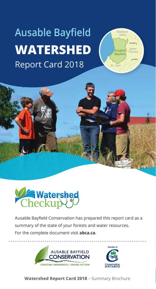 Ausable Bayfield
Forest conditions grades in Ausable Bayfield watersheds ranged from A to D, with mostly D grades.
Surface water quality grades ranged from A to D with mostly C grades.
In terms of wetland cover, more water retention areas are needed in strategic locations such as field edges, according to the Ausable Bayfield Watershed Report Card.
Groundwater quality is generally good in Ausable Bayfield watersheds but several wells “approached the drinking water standard for nitrate or the guideline for chloride, and therefore received grades less than A.”
To find out more visit this link:
 St. Clair Region
Forest conditions grades in the St. Clair Region watersheds ranged from C to F, with mostly D grades.
Surface water quality grades varied between C and D, with mostly D grades.
Wetland cover grades varied from D to F with mostly F grades.
For groundwater, nitrate concentrates were better than the drinking water guidelines for all wells – resulting in an A grade – but concentrations of chloride approached or exceeded the drinking water guidelines at some wells, resulting in a grade less than A.
To find out more visit this link:
Taking action along Lake Huron based on Watershed Report Cards
New, updated Watershed Report Cards provide you with information on the state of your local watershed. They report to you about where environmental improvements are being made, where improvements are needed, and how you can help to protect creeks, streams, groundwater, rivers, and Lake Huron.
Each Watershed Report Card provides a list of actions you can take to protect water, soil, and habitat for living things:
Taking action in Grey Sauble Watersheds
Increasing riparian areas (trees and shrubs) along watercourses is an extremely effective action because this improves water quality, forest cover, and can contribute to wildlife and fish habitat, according to Grey Sauble Conservation. Most Grey Sauble watersheds received good to excellent grades in the 2018 Report Card, according to the Grey Sauble Conservation Authority. “A healthy watershed provides economic, social and ecological benefits to all our communities,” said Chief Administrative Officer Sonya Skinner. “Given our significant increases in development and tourism, our positive Watershed Report Card results encourage us to continue and increase local efforts with our many partners, stakeholders, municipalities and developers.”
The Grey Sauble Watershed Report Card encourages you to: plant native species, particularly trees and shrubs along streams, lakes, rivers, and ponds; learn about invasive species and how you can prevent them from spreading; decommission unused wells, as they provide a direct pathway to our groundwater systems; inspect and pump out your septic system every three to five years; do not dump anything down roadside catch basins because they are connected directly to local waterbodies; conserve water by using a rain barrel and low-flow household products; keep livestock out of waterways; employ cover crops to reduce erosion; reduce or eliminate the use of chemicals, pesticides, and fertilizers; and to keep recreational activities clean and have your boat motor checked for leaks.
For more actions you and your community can take visit this link:
Taking action in Saugeen Valley Watersheds
Saugeen Conservation recommends you dispose of litter and hazardous chemicals properly; collect rainwater for your garden; start or maintain a compost; plant native trees and shrubs; conserve and protect wetlands; reduce, re-use, recycle; plant a garden for butterflies, bees and other pollinators; do not move firewood; connect existing natural areas such as woodlands and windbreaks with wildlife corridors; protect soil from wind and water erosion through good conservation practices; naturalize shorelines by creating buffers along creeks and lakes; inspect your septic system every three to five years; and establish or maintain good crop rotation and soil health.
For more actions you and your community can take visit this link:
Taking action in Maitland Valley Watersheds
Maitland Conservation recommends that you: increase natural cover on the land to improve the health of local watersheds and help to moderate the effects of climate change; assess your property and create more natural cover such as stream buffers and windbreaks to protect your land from the extremes of heat, wind and rain; plant tree and shrubs to increase forest cover; reforest flood plain and steep river valley slopes to improve the health of rivers and streams; and plant cover crops to increase residue cover and organic matter. If you farm, you are encouraged to consider cropping and tillage techniques that keep soil and nutrients on the ground and out of watercourses. Around your home or cottage you are encouraged to plant native trees and shrubs to promote species diversity and create wildlife habitat; plant perennial wildflower beds and butterfly gardens to provide nectar for pollinators; naturalize your lawn with ground cover, shrubs and perennial plants; and maintain a natural shoreline as trees, shrubs and ground cover help to protect the shoreline from erosion. “Whether your planting project involves hundreds of trees and shrubs or a single shade tree in your yard, it will have a positive impact on our local environment,” according to the Maitland Valley Watershed Report Card.
Weather extremes and intensive land use negatively affect surface water ecosystems and planting trees is one of the ways to help address this. Maitland Conservation is working with landowners and municipalities to address stormwater issues in order to slow down runoff and allow it to spread out and soak into the ground to help keep soil and nutrients out of watercourses.
For more actions you and your community can take visit this link:
Taking action in Ausable Bayfield Watersheds
The Ausable Bayfield Watershed Report Card encourages you to ‘Save; Seed; and Steward.’ You can save when you: protect and enhance natural areas on your property; and reforest less agriculturally productive land and extend forest along fencerows. You can ‘Seed’ when you plant native plants, trees, and shrubs; and when you note wet areas on your property, and call for a restoration site visit. You can ‘Steward’ when you: inspect and pump out your septic system every three to five years; use best management practices (BMPs).
These ACTions help to Avoid (improve filtration); Control at or near the source; and Trap and Treat. These best management practices can be rural actions (such as buffers; two-stage ditches; grassed waterways; berms; minimum tillage or no-till; and cover crops, or urban actions (such as stormwater ponds; rain gardens; rain barrels; less pavement; natural cover).
Wetland restoration and tree planting are among the actions citizens can take to protect water, soil and living things in their watershed, according to Ausable Bayfield Conservation. Other actions (to ‘save, seed, and steward’) include planting of cover crops and more year-round vegetative cover. “We have to continue to look for those save, and seed, and stewardship opportunities,” according to Mari Veliz, Healthy Watersheds Manager. The most effective actions, she said, are the ones that hold back, slow down, and infiltrate the stormwater running across the land before it reaches berms and buffers.
Those ‘ACTions’ include reduced tillage and cover crops. Reducing and slowing down runoff is also important in towns and villages. “The same goes for urban actions – we think of stormwater ponds but, really, they’re the last line of defence.” She said more rain barrels, rain gardens, natural cover, and less impervious pavement are “the kinds of things we should be working towards to make improvements to our landscapes.”
For more actions you and your community can take visit this link:
Taking action in St. Clair Region Watersheds
The St. Clair Region Watershed Report Card encourages you to: plant native trees, shrubs, and wildflowers; retire and naturalize unproductive farmland; create wetlands to maintain water balance during wet and dry periods; reduce the amount of household chemicals you use and store such as antifreeze, paint, lawn chemicals, detergents, and cleaners, etc.; inspect and pump out your septic system every three to five years; restrict livestock from waterways; ensure manure storage facilities are adequate; and decommission unused wells to prevent groundwater contamination.
For more actions you and your community can take visit this link: